
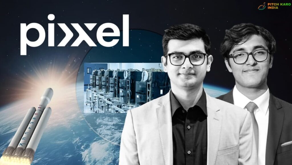
From Firefly To Honeybee: How Pixxel Is Giving Satellites A New Set of Eyes
Pixxel: There is something almost magical about looking at Earth from space. From hundreds of kilometres above the ground, a satellite can see forests, farms, cities, rivers and oceans. But seeing something is not always the same as understanding it. Sometimes, the most important information is hidden beyond what our eyes can see. That is where hyperspectral imaging becomes incredibly powerful.
Instead of capturing Earth in only a few broad colours, hyperspectral satellites observe many narrow portions of the electromagnetic spectrum. This can reveal subtle differences in vegetation, minerals, soil, water, pollution and other materials that may look almost identical in an ordinary satellite image. India’s Pixxel is building its business around this idea.
The Bengaluru-based space technology company is developing a growing constellation of hyperspectral Earth-observation satellites and the data systems needed to turn those observations into useful information. Its journey reflects a much bigger change taking place in India. The country’s private space sector is no longer limited to rockets and launch services. Indian startups are increasingly working on satellites, sensors, Earth observation, space data and applications built on information collected from orbit.
Pixxel’s story is particularly interesting because of the way its satellite programme is evolving. The company’s Firefly constellation is now operational, while its next-generation Honeybee constellation is designed to expand hyperspectral coverage much further into the shortwave infrared region. Pixxel says all six Firefly satellites were successfully launched in 2025 and are now operating in orbit.
The difference between Firefly and Honeybee is not simply about putting more satellites into space. It is about widening the range of information those satellites can collect. And that could change how governments, businesses and researchers understand the planet.
What Exactly Is Pixxel Trying to See From Space?
To understand Pixxel’s work, it helps to first understand the problem with ordinary satellite images. A conventional camera generally captures information through a limited number of broad colour channels. Human vision itself is limited to a relatively small portion of the electromagnetic spectrum, commonly called visible light.
But materials interact with light in different ways. Plants, minerals, soil, water and man-made materials can each produce distinctive spectral signatures. These differences may not be obvious in a normal photograph, but a hyperspectral sensor can detect them by measuring many narrow wavelength bands.
Imagine looking at two fields that appear equally green. To your eyes, they might look almost identical. But a hyperspectral sensor could potentially detect differences related to vegetation health, water stress, crop condition or other characteristics. The same basic principle can be applied to minerals, forests, water bodies and industrial environments.
This is what makes hyperspectral imaging so valuable. It adds another dimension to satellite observation. Instead of asking only, “What is here?” the data can help analysts ask, “What is it made of, what condition is it in, and how is it changing?” That is the opportunity Pixxel is pursuing.
From Firefly to Honeybee
Pixxel’s first commercial constellation is Firefly. According to Pixxel’s current information, the Firefly satellites provide hyperspectral imagery in the visible and near-infrared range, covering approximately 470 to 900 nanometres, with a ground sample distance of around 5.4 metres. The constellation is designed for high-resolution, high-frequency monitoring, and Pixxel’s specifications list 135 available spectral bands, with up to 45 selectable bands per capture. That already represents a significant amount of information. But Pixxel’s ambitions go further.
The company’s Honeybee constellation is designed to extend coverage from the visible and near-infrared wavelengths into the shortwave infrared, reaching approximately 470 to 2500 nanometres. The planned satellites are designed around a ground resolution of roughly 5 metres and approximately 250 available spectral bands across the wider range.
In simple terms, Honeybee is being designed to see a much broader portion of the electromagnetic spectrum. That matters because some materials reveal particularly useful characteristics in the shortwave infrared range. It means Pixxel is not simply building a larger version of Firefly. It is expanding the kind of information that its constellation can collect.
Why Hyperspectral Data Could Be So Important
The real value of a satellite is not necessarily the satellite itself. The real value lies in what people can learn from the data. A hyperspectral image can contain enormous amounts of information. When processed correctly, that information can support decisions in agriculture, environmental monitoring, mining, climate research, disaster management, infrastructure monitoring and other fields.
For farmers and agricultural organisations, spectral information can help identify changes in vegetation and crop health. For mining companies, hyperspectral data can help identify mineral characteristics and geological patterns.
For environmental organisations and governments, it can provide additional information about forests, water bodies, land degradation and other changes across large areas.
For companies, repeated satellite observations can create a way to monitor assets and environments without physically visiting every location. This is where Pixxel’s business model becomes more interesting than simply selling satellite photographs.
The company describes itself as a space data company that is building both a hyperspectral satellite constellation and analytical tools designed to extract insights from that data. The ambition is essentially to turn what satellites see into information that people can use.
Firefly: The First Major Step
Firefly represents an important milestone in Pixxel’s journey. The company says its first commercial constellation consists of six satellites. All six were successfully launched during 2025 and are now operating in orbit. Pixxel describes Firefly as its first commercial constellation, designed for high-resolution and high-frequency hyperspectral imaging at a global scale. The constellation is designed to provide frequent observations of the planet.
According to Pixxel’s technical specifications, the Firefly constellation operates in a sun-synchronous orbit at roughly 590 kilometres altitude and can provide a revisit capability that varies depending on constellation configuration and latitude. Pixxel’s more recent May 2026 specifications indicate different revisit expectations by latitude, while earlier constellation documentation describes a six-satellite configuration capable of approximately daily revisit.
This frequent monitoring is important because Earth is constantly changing. A single satellite image provides a snapshot. Repeated observations can provide a story.
A farmer may want to understand how a crop changes over time. A mining company may want to monitor an area repeatedly. Environmental agencies may want to identify changes in vegetation or water. The more frequently a satellite can observe an area, the more useful its data can become for monitoring change.
Honeybee Is Designed to Go Even Further
The next major chapter is Honeybee. Pixxel’s planned Honeybee constellation is designed to operate across a much wider spectral range, from approximately 470 to 2500 nanometres. The company’s current specifications describe around 160 visible and near-infrared bands and about 100 shortwave infrared bands, with a total of roughly 250 available bands.
The planned spatial resolution is around 5 metres. The constellation is expected to operate in a sun-synchronous orbit, with the exact altitude still subject to change in Pixxel’s specifications. The company currently describes Honeybee as a future constellation, with its product documentation indicating a planned launch timeframe in 2027.
Before the full Honeybee constellation, Pixxel has also planned Honeybee-0, a technology demonstrator designed to test expanded visible-to-shortwave-infrared capabilities.
Pixxel’s specifications describe Honeybee-0 as having approximately 450 spectral bands across the 400 to 2550 nanometre range, with an expected ground sample distance of about 8 metres. Its planned launch is listed for 2026 in the company’s May 2026 documentation.
That technology demonstrator is important because ambitious satellite systems have to be tested step by step. Before deploying a large constellation, companies need to prove that the sensors, electronics, communications, processing systems and data pipelines can work together reliably in space.
Why Shortwave Infrared Matters
The move into shortwave infrared is one of the most important parts of Pixxel’s Honeybee strategy. Visible light tells us a lot, but it does not tell us everything. Shortwave infrared can reveal characteristics that are difficult to distinguish in visible imagery. Different materials can have distinctive responses in this part of the spectrum, creating opportunities for more detailed analysis. For agriculture, this can potentially provide additional information about vegetation and water-related conditions.
For mining and geology, spectral signatures can help with identifying and analysing minerals. For environmental monitoring, additional spectral information can improve the ability to distinguish different materials and detect changes.
The exact usefulness depends on the application, the quality of the data, atmospheric conditions, processing methods and the expertise of the person analysing the imagery. But the underlying idea is powerful. The more of the spectrum a satellite can reliably observe, the more information scientists and businesses may have available to understand what is happening on the ground.
A Satellite Is Only the Beginning
One mistake people sometimes make when talking about space companies is focusing entirely on rockets and satellites. A satellite is only one part of the larger system. Once a spacecraft collects data, that information needs to be transmitted, processed, calibrated, stored and delivered in a form that customers can actually use.
This is especially important for hyperspectral imagery because each scene can contain far more information than a standard photograph. Pixxel is therefore working on more than spacecraft.
The company also describes itself as developing analytical tools to extract insights from satellite data. Its product documentation includes different processing levels and data products designed for users working with Earth-observation imagery. This creates the possibility of a much broader business.
Instead of simply selling raw images, a space-data company can potentially help customers answer specific questions. Where is vegetation under stress? Where are certain minerals present? How is an industrial area changing? What environmental patterns are developing? The closer the company gets to answering these questions, the more valuable its data can become.
From Space Hardware to Space Intelligence
This shift from hardware to intelligence is happening across the global space industry. Satellites are becoming tools for collecting enormous amounts of information. Artificial intelligence, machine learning and advanced analytics can then be used to interpret that information.
View this post on Instagram
Pixxel’s vision fits naturally into this emerging model. The company is effectively trying to build an orbital sensing system that can continuously collect detailed information about Earth and then make that information useful to organisations. This is a different kind of space business. The end customer may not care which satellite captured an image. They care about whether the data helps them make a better decision. That could be one of the most important shifts in the commercial space economy.
Why This Matters for India
Pixxel’s journey is also significant because it represents the changing face of India’s private space sector. For decades, India’s space story was strongly associated with the Indian Space Research Organisation and national missions. That landscape is changing.
Private Indian companies are now working across different parts of the space ecosystem, including launch vehicles, satellite manufacturing, Earth observation, communications and space-based applications. Pixxel represents the Earth-observation side of this transformation.
Its work shows that India’s space ambitions are not limited to reaching orbit. There is also a huge opportunity in understanding what is happening on Earth once satellites get there. For India, this can create new capabilities while also building a commercial space industry that serves customers around the world.
A Global Business Opportunity
Earth observation is inherently global. A satellite does not need to remain over one country. It can observe agriculture in one region, forests in another, mining areas somewhere else and coastal environments elsewhere.
Pixxel’s constellation is being designed with global monitoring in mind. The company says Firefly is intended to provide high-resolution hyperspectral information at a global scale. That allows Pixxel to serve customers beyond India.
Government agencies can use satellite data for monitoring and planning. Enterprises can use it for operational intelligence. Researchers can use it for scientific analysis. The global nature of the market also means Pixxel is competing in an international industry. That makes the company’s technological performance especially important.
The Challenge of Turning Big Data Into Useful Information
Hyperspectral imaging is powerful, but it also creates a major challenge. More information is not automatically better information. A hyperspectral image can contain hundreds of spectral measurements for every location. Processing and interpreting that information requires sophisticated systems and expertise. This is why data analytics is such an important part of Pixxel’s strategy. If customers receive enormous datasets but cannot easily understand them, the value of the satellite technology becomes limited.
The future of companies like Pixxel may therefore depend as much on software, analytics and customer experience as on the satellites themselves. The winning space companies may not simply be the ones with the best sensors. They may be the ones that can turn complex observations into simple, actionable answers.
Firefly and Honeybee Show a Clear Evolution
Looking at Firefly and Honeybee together reveals how Pixxel’s technology roadmap is developing. Firefly focuses on hyperspectral imaging across the visible and near-infrared range, with approximately 5.4-metre ground sample distance. Honeybee is designed to expand that capability into shortwave infrared while improving the spatial resolution to around 5 metres.
That is a meaningful step. The company is effectively moving from seeing more detail within a particular part of the spectrum to seeing a broader range of information across the spectrum. And that could unlock new applications.
The Bigger Dream: A Health Monitor for Earth
Pixxel describes its larger mission as building a kind of “health monitor” for the planet. That idea captures the potential of Earth observation remarkably well.
Imagine having a system that regularly observes forests, farms, water bodies, minerals and landscapes around the world and helps identify important changes before they become difficult to manage. Satellites cannot solve environmental or agricultural problems by themselves. But they can provide information that helps people understand those problems earlier.
That is where the real promise lies. A satellite does not simply take a picture. It creates evidence. And when that evidence is collected repeatedly and analysed intelligently, it can become a powerful tool for decision-making.
India’s Private Space Sector Is Entering a New Era
Pixxel’s journey is part of a much larger story. India’s space economy is entering an era where private companies can build businesses around specialised technologies rather than simply supporting government missions. Some companies are building rockets.
Others are building satellites. Some are working on propulsion, communications or space infrastructure. Pixxel is concentrating on hyperspectral Earth observation and the intelligence that can be extracted from satellite data.
That diversity is important. A mature space economy needs more than launch capability. It needs companies that can create products, services and applications around the enormous amount of information generated in orbit. Pixxel is attempting to occupy exactly that space.
From Firefly to Honeybee, Pixxel Is Looking at Earth Differently
Pixxel’s journey is ultimately about changing the way we see our planet. Firefly has taken the company into commercial hyperspectral Earth observation with an operational six-satellite constellation. Honeybee is designed to push that capability further by extending spectral coverage into shortwave infrared and providing approximately 5-metre imagery. Honeybee-0 is intended to serve as a technology demonstration step toward that broader capability.
What makes this story exciting is that the technology has applications far beyond space itself. The data collected hundreds of kilometres above Earth can potentially help farmers understand crops, businesses monitor resources, scientists study environmental change and governments make better-informed decisions. That is the real promise of hyperspectral imaging.
It allows us to look beyond what our eyes can see. For India, Pixxel’s rise also sends a powerful message. The country’s private space industry is no longer simply about launching objects into orbit. It is increasingly about creating sophisticated technologies that can collect, analyse and commercialise information from space.
Firefly is an important first step. Honeybee could be the next major leap. And if Pixxel can successfully combine advanced sensors, reliable satellite operations, large-scale data processing and useful analytics, the company could become an important part of the global Earth-observation market. The future of space may not only be about travelling farther.
Sometimes, it is about seeing what is already here more clearly. From Firefly to Honeybee, Pixxel is betting that the next great space opportunity lies not just in looking down at Earth, but in understanding it in much greater detail.
Disclaimer: This article is intended for general informational and educational purposes only. The technical specifications, constellation plans, launch timelines, satellite status and capabilities mentioned in this article are based primarily on Pixxel’s publicly available information and product documentation available at the time of writing. Space missions and commercial plans can change because of technical, regulatory, operational or other factors. References to potential applications of hyperspectral imagery describe possible use cases and should not be interpreted as guaranteed results. Readers should consult Pixxel’s official documentation and other authoritative sources for the latest information before relying on any specific technical specification, launch schedule or business claim